Photo gallery: Building toward disaster – Aerial photographs from 1933 to 2014 show how development contributed to deadliest landslide event in U.S. history
Reporters: Ken Armstrong, Justin Mayo, Mike Baker and Jim Brunner
Interactive: Thomas Wilburn
Graphics: Mark Nowlin
Editor: Beth Kaiman
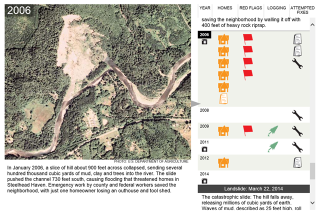
July 2014 (Seattle Times) – The decades preceding the deadly landslide near Oso reflect a shifting landscape with one human constant: Even as warnings mounted, people kept moving in. This interactive graphic tells that story, starting in 1887. Thirteen aerial photographs from the 1930s on capture the geographical changes; the hill is scarred by a succession of major slides while the river at its base gets pushed away, only to fight its way back. This graphic lets you go back in time and track the warnings from scientists; the failed attempts to stabilize the hill; the logging on or near the unstable slope; and the 37 homes that were built below the hill only to be destroyed. [more]
