Widespread storm surge threat as Tropical Cyclone Fani moves toward Northeast India
By Bob Henson
1 May 2019
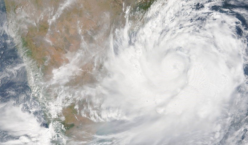
(Weather Underground) – Still a Category 3 storm as of Wednesday, Tropical Cyclone Fani is hurtling toward landfall in northeast India on a track that could spread a significant amount of storm surge as far as Bangladesh, well east of Fani’s center.
As of 12Z (8 am EDT) Wednesday, Fani was packing top sustained winds of 120 mph, according to the Joint Typhoon Warning Center (JWTC). The cyclone was located about 600 miles south-southwest of Kolkata, moving just east of due north at about 8 mph. Fani’s shower and thunderstorm activity (convection) had weakened considerably as a result of strong wind shear, so the top sustained winds may drop by Wednesday night and Thursday, although the official JTWC forecast was calling for slight strengthening. Fani’s wind field is likely to expand over time even if the top winds decrease. […]
By Friday night, Fani is expected to pass just west of Kolkata as a weakening Category 1 storm or high-end tropical storm. This trajectory could push sustained tropical-storm force winds across the metropolitan area of more than 14 million people. The Kolkata office of the India Meteorological Department warned of a wide array of potential wind-related impacts in coastal and near-coastal parts of West Bengal state, including the Kolkata area:
- Total destruction of thatched houses
- Extenstive damage to kutcha houses (huts made of mud, wood, straw, and dry leaves)
- Bending and uprooting of power and communication poles
- Major damage to roads and flooding of escape routes
- Widespread damage to standing crops and plantations
See weather.com for frequent updates on preparation for Fani. In addition, the India desk of weather.com has a continually updated page with details on Fani from an Indian perspective.
The storm-surge threat
The Bay of Bengal is one of the world’s most notoriously dangerous locations for storm surge. The India Meteorological Department warned Wednesday that storm surge could reach 1.5 meters (4.9 feet) across the Ganjam, Khurda, Puri, and Jagatsinghpur districts of India’s Odissa state. Model-based surge guidance issued at 0Z Wednesday shows the potential for surge further to the northeast as far as western Bangladesh, perhaps exceeding 2 meters (6.6 feet) in places.
The megacity of Kolkata sits almost 100 miles inland from the coast, on the east side of the Hooghly River. The coastal plain from Kolkata to the bay is lined with tidal creeks and riverine channels that allow the impacts of a major surge to reach well inland.
The latest storm surge forecast from IMD is concerning. It shows a low-lying coastline with a population in the millions potentially receiving a storm surge in excess of 2 meters in some locations, including parts of the Hooghly River system. Such a surge would displace a lot of people and cause significant damage, and it could prove deadly if a successful evacuation effort does not occur. [more]
Widespread Surge Threat as Fani Moves toward Northeast India