Kenneth threatens to bring extreme rains to cyclone-ravaged Mozambique – Rapid intensification expected
By Dr. Jeff Masters
23 April 2019
(Weather Underground) – Five weeks after catastrophic Tropical Cyclone Idai brought Mozambique its greatest natural disaster in history—with over 600 killed and damages in excess of $1 billion—a new tropical cyclone, Kenneth, threatens the nation.
As of the 10 am EDT Tuesday advisory from the Joint Typhoon Warning Center (JTWC), Kenneth was a tropical storm with 50 mph winds, headed west-southwest at 12 mph. The agency issuing the official forecasts for the South Indian Ocean, RSMC-La Reunion, had Kenneth as a minimal-strength tropical storm with 40 mph winds and a central pressure of 998 mb at 8 am EDT Tuesday. Kenneth was under moderate wind shear of 10 – 15 knots, over warm waters with sea surface temperatures of 30°C (86°F), and had excellent upper-level outflow—conditions very favorable for strengthening.
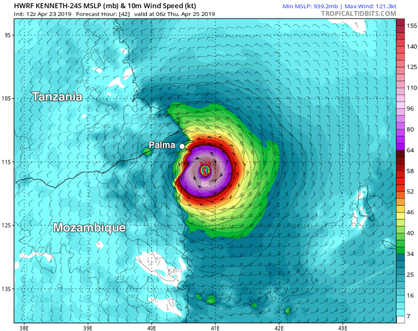
Both the JTWC and RSMC-La Reunion predict that Kenneth to intensify significantly over the next couple of days. The 10 am EDT Tuesday JTWC forecast called for Kenneth to peak as a Category 2 storm with 105 mph winds at 0Z Thursday, when the storm will be battering the Comoros Islands. If Kenneth enters a period of rapid intensification, which JTWC has flagged as a possibility, it could become even stronger. [more]
Kenneth Threatens to Bring Extreme Rains to Cyclone-Ravaged Mozambique