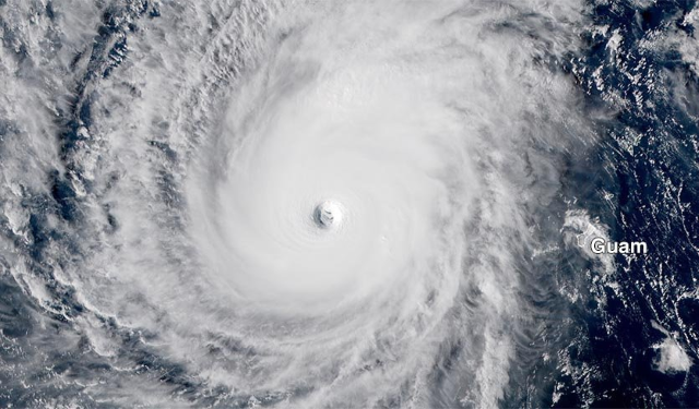
Super Typhoon Wutip hits 160 mph, making it first Category 5 storm ever recorded in February

By Dr. Jeff Masters
25 February 2019
(Weather Underground) – Super Typhoon Wutip underwent an impressive burst of rapid intensification on Monday morning in the waters about 300 miles west of Guam, topping out as Category 5 super typhoon with a central pressure of 915 mb and sustained winds of 160 mph at 2 am EST. Wutip is the first Category 5 storm ever observed in the Northern Hemisphere in the month of February.
According to NOAA’s Historical Hurricane Tracks database, only seven January and February Category 4 or Category 5 typhoons have been recorded in the Northwest Pacific since records began in the late 1940s. Wutip is tied with Super Typhoon Ophelia of 1958 as the strongest typhoon ever observed these two months. Ophelia peaked as a Category 5 storm with 160 mph winds on 13 January 1958. The previous strongest February typhoon on record was Super Typhoon Higos, which hit 150 mph winds on 10 February 2015.
It is very rare to see a Category 5 storm form with such cool ocean temperatures. Sea surface temperatures (SSTs) were a mere 26 – 27°C (79 – 81°F) during Wutip’s rapid intensification to Category 5 strength, and the ocean had a low total heat content. [more]
Wutip Hits 160 mph: First Category 5 Typhoon Ever Recorded in February