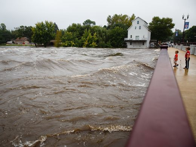
Iowa expects more rain, braces for record flooding
By Stephen Feller
24 September 2016 WASHINGTON (UPI) – Residents of Cedar Rapids and other parts of Eastern Iowa spent Saturday reinforcing preparations for floodwaters as some were evacuated from their homes and others were set to be told to leave later tonight. The National Weather Service on Saturday afternoon issued flood warning for eastern Iowa that river waters would continue to rise, in cases until some time Sunday and others not until the middle of the week, and state officials spent the day moving to protect property and help people get to safety. As of Saturday afternoon, the National Weather Service said in a forecast that flood warnings would continue deep into next week, with parts of the Shell Rock River not expected to fall below flood stage until Tuesday, the Iowa River not expected to fall below flood stage until Tuesday or Wednesday for much of the state. Evacuations have been recommended for more than 5,000 people in Cedar Rapids, with Iowa National Guard and other officials working to help where needed and make sure people are aware of the danger posed by floodwaters. The National Guard also will be enforcing a curfew from 8 p.m. Sunday night until 7 a.m. Monday morning in areas that are being evacuated. Depending on rain, the city is advising residents the river could reach 28 feet deep — which would inundate homes in the area if rain continues to fall. “We want you to today take care of your belongings and your pets [on Saturday],” Cedar Rapids Mayor Ron Corbett told the Des Moines Register, explaining the timing for evacuations. “[Sunday], we want you to take care of yourself.” [more]
Iowa expects more rain, braces for record flooding
By Kevin Hardy, MacKenzie Elmer and Molly Longman
23 September 2016 (USA TODAY) – Heavy rain has led to record river flooding in northeastern Iowa, with several locations along the Cedar and Shell Rock Rivers either at or nearing all-time record high crests.
Cedar Rapids, the state’s second-largest city, is awaiting its turn as the big mass of floodwater surges downstream. With the Cedar River rapidly rising, the mayor of Cedar Rapids promised residents Friday that the city would not be caught “off guard” like it was during 2008 flooding. The river should crest at 25.3 feet on Monday — well below the June 2008 crest of 31 feet — but still the city’s second-highest level on record, the National Weather Service said. Records go back to at least the early 1850s. Mayor Ron Corbett said there was still time for residents to protect their homes and businesses from flooding caused by the Cedar River, which is expected to crest sometime Monday. “We still have three days,” he said. “We can save a lot in three days.” More rain fell Thursday night and earlier Friday, and the weather service said the threat for flash flooding remained high through the day. Noting the possibility of even more rain in the area, forecasters said at least moderate flooding was likely in several areas. The town of Osage reached a record high crest Friday and the town of Shell Rock should reach a record high crest Saturday. [more]
