Video: An eye-opening flight over California’s dying forests
By Kurtis Alexander
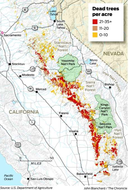
6 August 2016 McCLELLAN PARK, Sacramento County (San Francisco Chronicle) – Even before the plane left the runway, it was clear the crew of researchers examining the fallout from California’s historic drought would not return with good news. A column of gray smoke from a smoldering brush fire was visible from McClellan Airfield outside Sacramento, a reminder of the threat that the hot, dry weather posed for the state’s forests — the subject of the high-flying mission. The four crew members were halfway through two weeks of flights over landscapes shifting ominously from green to brown, and already they’d begun to draw their conclusion: The mind-boggling number of trees that have died in California due to drought — an estimated 66 million over five years — is only the beginning. The death toll will probably rise by tens of millions of trees, even if heavier rains come this year, said Greg Asner, head of the team from Carnegie Institution for Science in Washington, D.C.
Using technology that has diagnosed problems in the Amazon rain forest and the jungles of Borneo, the researchers are learning that California’s unprecedented tree die-off is moving well beyond its origins in the southern Sierra Nevada and along parts of the southern coast. It’s creeping farther north, and to higher elevations, not only providing tinder for wildfires, but also obstructing the forests’ fundamental ability to provide clean water and absorb carbon dioxide. “It’s not just the numbers of trees lost. … It’s the implications,” said Asner, who works out of Stanford University when he’s not in the air. “The scientist in me is quite happy that we have a predictive capability, but the human in me and the naturalist in me is quite shocked.” [more]
