Here’s what global warming has done to the season formerly known as winter
By Matt Smith
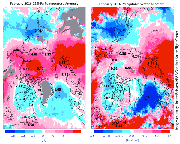
10 March 2016 (VICE News) – It’s not just you — it really is hot in here. Winter is coming to a warm, wet close in the Northern Hemisphere, knocking down records on the way. Though fading, the Pacific warming phenomenon El Niño helped drive the average temperatures in the continental United States to a new winter record. December-through-February readings were 4.6 degrees Fahrenheit (2.5 degrees Celsius) over the 20th century average, the National Oceanic and Atmospheric Administration reported this week. The season started off with a green Christmas across the East, while tornadoes raked Texas, the Gulf Coast, and the Southeast in December, February, and again in March. Even Alaska had its second-warmest winter on record. And while snow cover across the Northern Hemisphere was above normal in January, it was running far below normal in February, said Thomas Mote, a geographer and climatologist at the University of Georgia. Mote said the unusual heat comes from the combination of a long-term trend — the gradual warming of the planet — and the Pacific Ocean warming phenomenon El Niño, which drove global temperatures to a second consecutive annual record in 2015. The current El Niño is fading, but the bigger warming trend shows no sign of stopping, Mote said. “We have more periods with above-normal temperatures than we’re seeing with below-normal temperatures. That’s part of what we expect to see with a greenhouse-enhanced climate,” he said. “But certainly the magnitude of the changes and the pattern of the changes we’ve seen this year are very indicative of a strong El Niño event.” [more]
Here’s What Climate Change Has Done to the Season Formerly Known as Winter
