California waits anxiously for a ‘Miracle March’ or ‘Awesome April’ to offset the worst snowpack season on record in parts of the Sierra Nevada
By Bob Henson
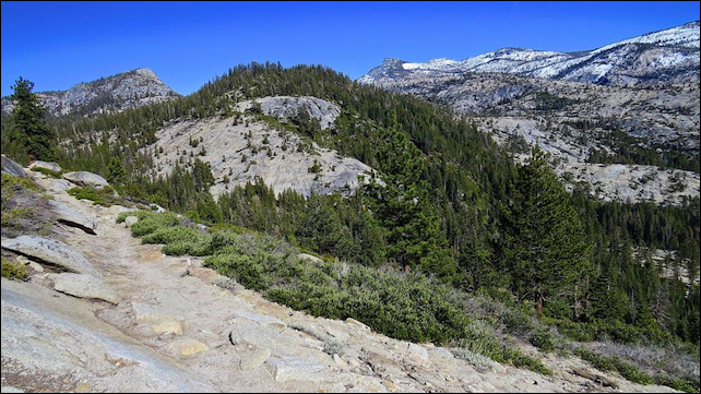
27 February 2015 (Wunderground.com) – Californians are watching anxiously to see if a “Miracle March” or “Awesome April” salvages the worst snowpack season on record thus far in parts of the Sierra Nevada. Snow that piles up across the mountain range from autumn through spring furnishes more than 60% of the state’s water for consumer and agricultural use. Winter precipitation across California hasn’t been too far from average, but even more than usual, most of it has fallen in a relatively small number of wet storms, mainly in the first half of December and early February. The San Francisco Bay area saw its first bone-dry January in more than a century of weather records. Outside of December, which brought 17 wet days, San Francisco (downtown) has seen just 14 days of measurable rain since October 1. In many ways this winter resembles 2013-14, when the “Ridiculously Resilient Ridge” just offshore steered wet systems well north of California. This year’s upper-level features (Figure 1, right) have tended to park a little bit east of last year’s, enough to extent record warmth to the Great Basin and allow the occasional big storm to push its way onshore while smaller, weaker storms spin across Southern California. Upper-level ridging has strengthened over the past month, leading Daniel Swain (California Weather Blog) to proclaim the arrival of the Ridiculously Resilient Ridge, Redux. A cardinal feature of this winter’s storms from California to Washington is their unusual warmth, which means that much of the water ran off from the Sierra as rain rather than accumulating as snow. Reservoirs in northern California got a healthy boost, now running from 70% – 100% of average for this time of year, but central California reservoirs are still hurting, most of them holding half at best of the seasonal average. The “reservoir” of water within snowpack is in far worse shape from the Sierra Nevada north through the Cascades, with most sites reporting 25% or less of the amount of water typically stored in snowpack at this time of year. Figure 2 [above] illustrates the depleted state of snowfall in Yosemite National Park at elevations of more than 8,000 feet. [more]
Crunch Time Ahead for California Drought Relief
