Record heat wave continues in Sydney – Drought declared in record 80 per cent of Queensland
By Peter Hannam, Environment Editor
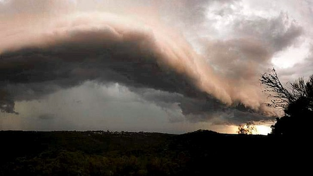
21 March 2014 (Sydney Morning Herald) – Sydney faces the chance of more thunderstorms on Friday and over the weekend as the city’s run of record warm weather heads towards a third week. Parts of the western suburbs and the Blue Mountains are likely to see thunderstorm activity from late morning until tonight with eastern areas likely to be spared. There is a small chance of a shower moving over ANZ Stadium for the Wests Tigers v Rabbitohs game tonight. For Saturday, afternoon sporting and other outdoor activity may be disrupted, particularly in the west with more storms expected and showers likely over the rest of the city, said Ben Domensino, senior meteorologist with Weatherzone. “We’ve got this instability just lingering around,” Mr Domensino said, adding the city was unlikely to get a repeat of recent severe storm fronts moving in as happened last Saturday. Unusually warm weather is contributing to the “pretty good set-up for thunderstorms”, conditions that are likely to prevail well into next week, Mr Domensino said. Friday’s temperatures recently topped 26 degrees, making it the 19th consecutive day above 25 degrees and extending the record well beyond the previous tally of 16 such days in 1977. The revised forecast by the Bureau of Meteorology is for at least 25 degrees each day until Monday, indicating the record series may extend to at least 21 days. Large blocking high-pressure systems in the Tasman have been key to keeping cooler conditions much further south than usual. “At this time of year, you’d typically start to see cold fronts becoming a bit more prominent,” Mr Domensino said. So far this month, the average maximum is running at 26.9 degrees, not far below the record of 27.1 degrees set in 2006, he said. March 2006 had its first 13 days reach at least 26 degrees – a record stretch that been eclipsed this year with 17 such days up including today, Weatherzone said. Along with the warm weather, though, drier-than-usual conditions have generally prevailed. A record of almost 80 per cent of Queensland has been declared in drought and much of northern NSW remains in severe rainfall deficit conditions. [more]
