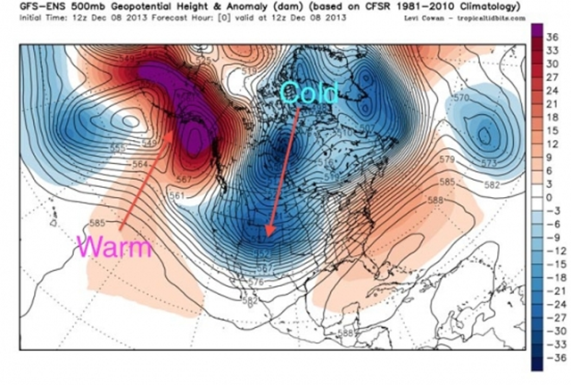
While most of U.S. froze, parts of Alaska set record highs
By Andrew Freedman
10 December 2013 (Climate Central) – While the continental U.S. has been shivering from coast-to-coast with temperatures dropping as low as minus-40°F amid one of the most severe early December cold snaps in several years, one state bucked the trend in an historic way. The same contorted jet stream pattern that brought the brutal cold to the lower 48 states pushed a pulse of milder-than-average air into Alaska, where some spots recorded temperatures unheard of for December. Along Alaska’s northern coastline, which lies above the Arctic Circle, the warmest December temperatures on record in at least 70 years occurred this past week. At the airport in Deadhorse, which serves the oil production hub of Prudhoe Bay, the temperature hit 39°F on December 7, the highest December temperature on record there since at least 1968, said Rick Thoman of the National Weather Service (NWS) in Fairbanks in an interview. Even more notable, perhaps, was the fact that it was raining, rather than snowing. Rain there is unusual so late in the year. Previously, the highest December temperature recorded at any of the two climate observation sites that have served Prudhoe Bay over the years was 35°F, set on Dec. 31, 1973, according to Chris Burt, a blogger at WeatherUnderground. [more]
