Image of the Day: Satellite view of Kedarnath after June 2013 flood
By Raju Gusain
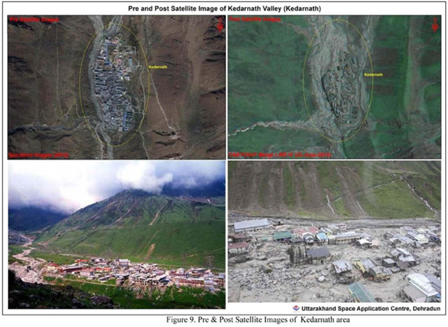
29 June 2013 Dehradun (India Today) – New satellite images of Kedarnath clearly indicate the devastation which has taken place there. The images, taken by US based NASA’s Landsat 8 satellite on 23 June 2013, when compared with old National Remote Sensing Centre (NRSC) images provided by the Uttarakhand Space Application Centre, show the scope of damage in the Mandakani valley. The Kedarnath valley is seismically and ecologically very sensitive and fragile. On 16th night and 17th June morning two major cloudbursts hit the valley causing mass damage to property and human lives. Pre and post event satellite image shows the mass damage to property and other infrastructure. The comparison images also highlight that in the past one stream used to flow in the background of Kedarnath shrine, which used to form two after coming down. New image shows the birth of a new third stream. The channel of the stream too has become broad after the disaster. [more]
Exclusive: NASA satellite images show new stream in Kedarnath after disaster