Google Street View sends cameras into Namie, an abandoned town in Fukushima where once 21,000 people lived
By David McNeill
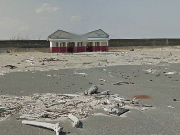
27 March 2013 TOKYO (Independent) – Google’s Streetview cars have been in to the area around the Fukushima nuclear plant for the first time. Their maps reveal the destruction wrought by Japan’s huge earthquake – and give the 21,000 residents forced to flee the chance to see what they left behind. It is a nuclear-era Mary Celeste, a town left virtually untouched since its 21,000 residents fled two years ago. Rubble and roof tiles still litter the streets from the huge earthquake that dislodged them on 11 March 2011. A ship lies beached beside a main road, washed up by the tsunami that pummeled the coastline less than an hour later. Homes and schools sit empty and abandoned, poisoned by the invisible radioactive payload from the nearby Daiichi nuclear plant that settled over everything here in the days after the Fukushima meltdown began. Namie in Fukushima Prefecture will always be synonymous with the world’s worst nuclear disaster since Chernobyl. Like the Ukrainian city of Pripyat, it is a nuclear ghost town, gradually being reclaimed by nature. After the tsunami, bodies lay here undiscovered for a month because nobody could be found to retrieve them. Government officials concealed the spread of radioactivity, leaving the town’s citizens to be poisoned. Today, Tomotsu Baba, its mayor, serves a population that has been scattered across Japan, driven out by contamination. “Many want to know the current state of the disaster area,” he says. “They wonder what’s become of it and feel a great need to see it for themselves.” Now they can. Google Street View is giving Namie’s nuclear refugees a virtual tour of their uninhabitable streets and homes. [more]