NASA data registers strong deforestation signals in Sumatra, Borneo, Brazil, Gabon
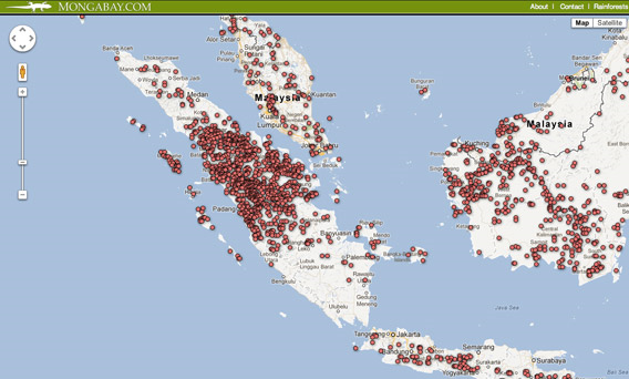
29 January 2013 (mongabay.com) – NASA satellites picked up signals of extensive potential deforestation in Sumatra, Borneo, Central Africa, the Brazilian and Peruvian Amazon, the Chocó in Colombia and Ecuador, and the Chaco region of Paraguay between October 1 and December 31, 2012, according to the latest update on Mongabay.com’s Global Forest Disturbance Alert System (GloF-DAS). Deforestation signals were particularly strong on the Indonesian island of Sumatra, where large areas of forest have been converted for palm oil and pulp and paper production in recent years. In Africa, Gabon was riddled with potential deforestation hotspots, as was the western part of the Republic of Congo. [more]
NASA data registers strong deforestation signals in Sumatra, Borneo, Brazil, Gabon