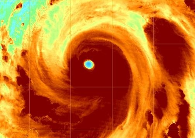
Super typhoon Jelawat to threaten Okinawa then Japan
By Jason Samenow
26 September 2012 Another monster typhoon has spun up in the western Pacific. Following super typhoon Sanba that ripped across Okinawa and then into South Korea, super typhoon Jelawat is also eyeing Okinawa before a possible encounter with Japan. Jelawat is the equivalent of a category-4 hurricane, with peak sustained winds of 150 mph. Briefly Tuesday, it reached category-5 strength with maximum sustained winds of 160 mph becoming the second strongest storm on Earth in 2012, trailing only Sanba whose peak winds reached 178 mph. Jelawat is currently positioned 570 miles south-southwest of Kadena Air Force Base on Okinawa and is moving northwest at around 6 miles per hour. It is expected continue this motion for a couple more days, before turning more to the northeast. The Joint Typhoon Warning Center (JTWC) projects it will be in the vicinity of Okinawa Saturday. Then, Jelawat is forecast to continue northeastward – gaining speed – towards mainland Japan with a possible landfall south of Tokyo near Hamamatsu on Honshu’s south coast Sunday into Monday. Note, however, the JTWC cautions: “There remains low confidence in the extended forecast track.” The storm has an impressive appearance on satellite right with now with a large, well-defined eye about 29 miles across. However, it is expected to gradually weaken due to increasing wind shear and decreasing water temperatures. It is predicted to be the equivalent of a category 1 or 2 storm when it’s near Okinawa and perhaps just a minimal hurricane or tropical storm when it affects mainland Japan.
