Super Typhoon Bolaven bears down on Okinawa, Typhoon Tembin to follow
By John Kraft
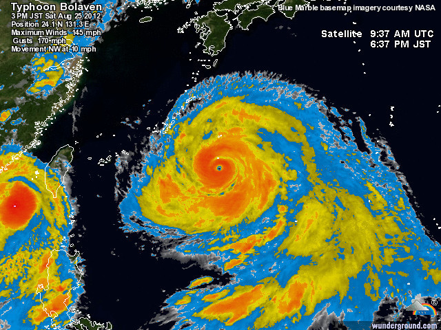
25 August 2012 Super Typhoon Bolaven now has sustained winds of 146 mph and gusts to 188 mph. It is expected to hammer down on the small island of Okinawa, Japan where 7 U.S. military installations have almost 50,000 military, family members, civilians and contractors await the impending storm. The center of the storm is projected to pass within 5 nautical miles of Kadena Airbase, the largest of the installations. The storm which has grown to over 700 miles across in size will rival all previous storms in the last 13 years. Okinawa is now starting to feel the effects and the full strength of Bolaven is expected to start approximately 1600hrs on Sunday. There is a second storm right behind Bolaven, Typhoon Tembin, which is expected to also hit Okinawa 24 hrs after Bolaven passes. Typhoon Tembin is currently a strong Cat 2 typhoon. I imagine the second Cat 2 Typhoon will seem like a light breeze after Bolaven passes. Okinawa is 13 hours ahead of EST.