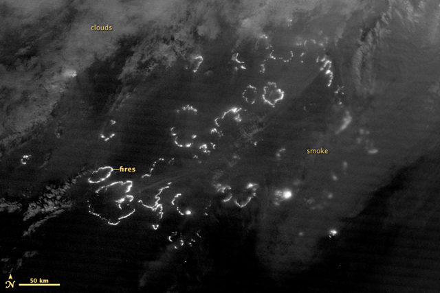
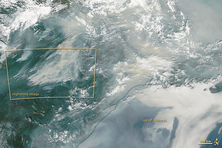
Image of the Day: Nighttime satellite view of Siberia forest fires, 3 August 2012
Caption by Adam Voiland
7 August 2012 For more than a decade, scientists have used data from instruments on NASA’s Terra and Aqua satellites to map the locations of wildfires burning around the globe. Now researchers have a new tool for observing fire. The Suomi National Polar-orbiting Partnership satellite (S-NPP) carries an instrument so sensitive to low light levels that it can detect wildfires in the middle of the night. On August 3, 2012, the Visible Infrared Imaging Radiometer Suite (VIIRS) on Suomi-NPP acquired the above image of wildfires blazing in eastern Siberia. The image is from the instrument’s “day-night band,” which sensed the fire in the visible portion of the spectrum. The brightest fires are white; smoke is light gray. The Moderate Resolution Imaging Spectroradiometer (MODIS) instrument on NASA’s Aqua satellite, acquired a view of the same group of fires on the same day (lower image). The fires detailed in the yellow box were burning in the southeastern part of Yakutia, near the port city of Yakutsk along the Lena River.
The vast majority of Russian wildfires occur in Siberia, generally along the southern border. One exception was 2010, when extreme drought and high temperatures ignited a rash of fires west of the Ural Mountains near Moscow. This year’s blazes have followed the typical pattern and occurred primarily east of the Urals. Official estimates differ on the size of the area affected by burning, ranging from 18,000 to 23,000 hectares (70 to 90 square miles), according to news reports.
Night View of Fires in Siberia

