Graph of the Day: Retreat of the Ata Glacier, 1915-2005
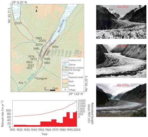
The Ata Glacier (29° 10′ N, 96° 48′ E), with a length of 16.7 km and an area of 13.8 km2, is on the southern slope of Mount Kangri Karpo in the southeastern TBP (Fig. 3d). The glacier was photographed in 1933 (ref. 21), 1976 (ref. 20) and 2006 (this study). We studied this glacier in detail using the historical photos, in situ observations and the 1917 1:125,000 topographic map compiled by the US Army (www.lib.utexas.edu/maps/ams/china; Fig. 3f,g). The glacial reduction averaged less than 20 m yr−1 between 1917 and 1954, increased to more than 30 m yr−1 from 1955 to 1984, increased again to more than 60 m yr−1 after 1985 and exceeded 80 m yr−1 in 2005/2006. The history of the Ata Glacier thus illustrates the largest amplitude of glacial retreat and reveals an accelerating trend in retreat since the 1990s.
Different glacier status with atmospheric circulations in Tibetan Plateau and surroundings