Graph of the Day: Australia Rainfall Deciles, 1997-2011
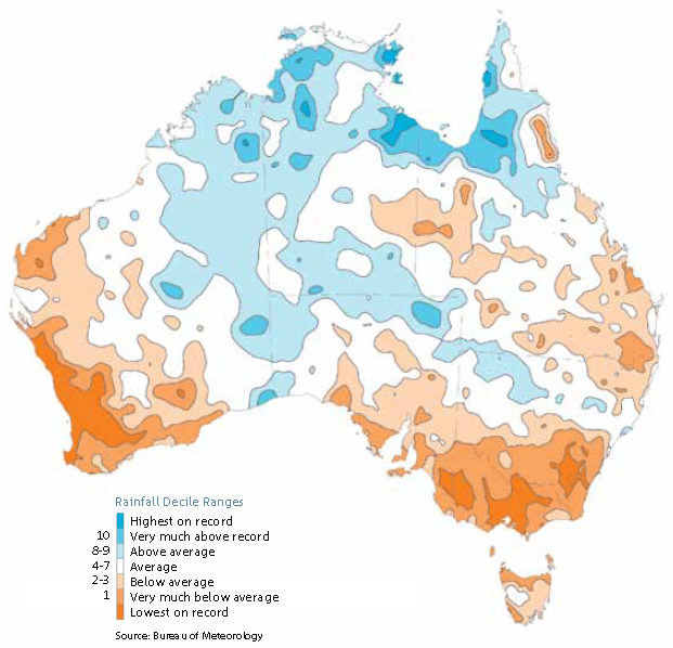
April to September (autumn and winter) rainfall deciles from 1997 to 2011 for Australia (a decile rainfall map shows whether the rainfall is above average, average or below average for the most recent 15-year period, in comparison with the entire rainfall record from 1900). Areas of highest on record and lowest on record are also shown. BOM Australia’s rainfall is highly variable. During recent decades, there has been a general trend toward increased spring and summer monsoonal rainfall across Australia’s north, higher than normal rainfall across central parts of the continent, and decreased late autumn and winter rainfall across the south. A very strong La Niña event in 2010, followed by another La Niña event in 2011, brought the highest two-year Australian-average rainfall total on record. Many rainfall records were broken during this period. Southwest Western Australia experienced its lowest rainfall on record in 2010 and only average rainfall during 2011, in contrast to the rest of the continent. The record rainfall of 2010 and 2011 fell in spring and summer in the southeast of the continent. Rainfall was below average for the period April to July 2011, continuing the longer-term drying trend observed over the winter half of the year for this region. Recent drying trends across southern Australia in autumn and winter have been linked to circulation changes. The causes of these changes are an area of active research.