La Niña returns, bringing more severe weather – Drought likely to continue in East Africa, Texas, and Oklahoma
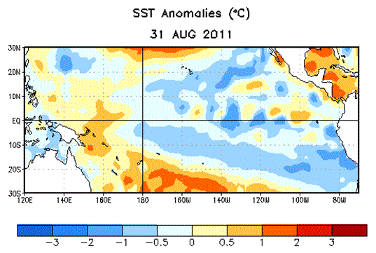
Washington (AFP) Sept 8, 2011 – The weather phenomenon known as La Niña is returning for another season, likely bringing more drought, heavy rains and severe weather to some parts of the world, US forecasters said Thursday. Experts at the National Oceanic and Atmospheric Administration (NOAA) Climate Prediction Center upgraded last month’s La Niña Watch to a La Niña Advisory, the agency said in a statement. The back-to-back emergence of the trend — which causes cooler than average temperatures in the Pacific Ocean — is not unheard of and happens about half the time, NOAA said. “La Niña, which contributed to extreme weather around the globe during the first half of 2011, has re-emerged in the tropical Pacific Ocean and is forecast to gradually strengthen and continue into winter,” it said. The June 2010 to May 2011 La Niña “contributed to record winter snowfall, spring flooding and drought across the United States, as well as other extreme weather events throughout the world, such as heavy rain in Australia and an extremely dry equatorial eastern Africa.” Over 12 million people across the Horn of Africa are reeling from the region’s worst drought in decades, which led the United Nations in July to declare the first famine this century. The weather pattern was blamed for extremely heavy downpours in Australia, Southeast Asia and South America over late 2010 and early 2011. “This means drought is likely to continue in the drought-stricken states of Texas, Oklahoma and New Mexico,” said Mike Halpert, deputy director of the Climate Prediction Center. The northwestern United States can brace for a colder winter than usual while southern US states should see a warming trend, he said.