Graph of the Day: Earth Movement by Humans and Rivers in the U.S.
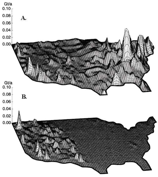
Earth movement by humans and rivers. Maps of the United States showing, by variations in peak height, the rates at which earth is moved in gigatonnes per annum in a grid cell measuring 1° (latitude and longitude) on a side, by (A) humans and (B) rivers. Hooke (1999) / EPA Surface mining and reclamation have been identified as the dominant driver of land cover/land-use change in the central Appalachian coalfields and have produced significant changes in the region’s topography, hydrology, vegetation, groundwater, and wildlife (Townsend, et al., 2009; Loveland, et al., 2003; U.S. EPA, 2003, 2005). Coal mining in this region was identified as the greatest contributor to earth-moving activity in the United States (Hooke, 1999).
The Effects of Mountaintop Mines and Valley Fills on Aquatic Ecosystems of the Central Appalachian Coalfields (2011 Final) [pdf]