Radiation-contaminated area spans 800 square km, new map shows
By Hisae Sato and Fumikazu Asai
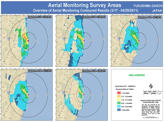
12 May 2011 The total area contaminated with radiation from the Fukushima No. 1 nuclear power plant is estimated at about 800 square kilometers, or about 40 percent the size of Tokyo, according to a radiation map created by the science ministry and U.S. Department of Energy. The report uses the same level of contamination (555,000 becquerels or higher of cesium-137) that was used to issue compulsory evacuation orders in the Chernobyl nuclear accident in 1986. … The report’s radiation levels were determined in April by measuring, from about 150-700 meters above ground, levels of accumulated radiation on the ground. The areas measured were divided into 1- to 2-square-kilometer zones. According to the map, about 800 square kilometers are contaminated with accumulated cesium-137 of 600,000 becquerels or higher per square meter. The substance has a half-life of about 30 years. This area is largely the same as the Fukushima no-entry zone and planned evacuation zone designated by the central government. The total area is about one-tenth the size of the contaminated area in the Chernobyl nuclear accident. … About 370,000 to 630,000 terabecquerels of radioactive substances are estimated to have been released by the crippled plant, according to a report by the Nuclear and Industrial Safety Agency and the Nuclear Safety Commission of Japan. This radiation amount equals about one-tenth the amount released from the Chernobyl nuclear power plant, whose nuclear reactor was destroyed. …
Radiation-contaminated area spans 800 square km, new map shows