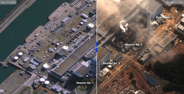
March 15, 2011
Photo gallery: Satellite Photos of Japan, Before and After the Quake and Tsunami
By ALAN McLEAN, MATTHEW ERICSON and ARCHIE TSE
[Visit the site and move the slider to compare satellite images from before and after the disaster.] 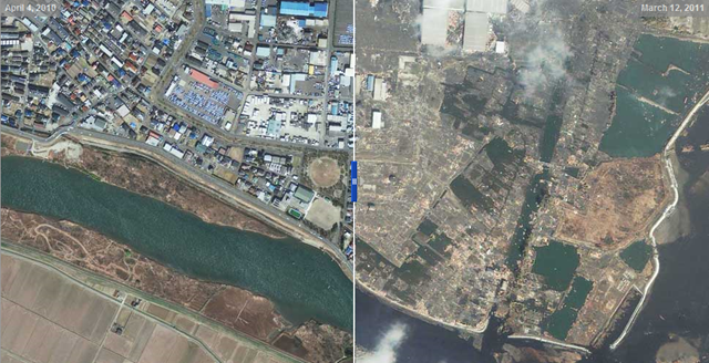 Satellite Photos of Japan, Before and After the Quake and Tsunami
  Japan tsunami – before and after pictures