February 26, 2011
Graph of the Day: Deforestation in Riau Province, Sumatra, 2001-2008
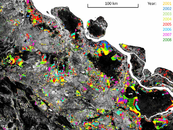
Temporal disaggregation of the moderate spatial resolution forest cover loss map for Riau province, Sumatra. Landsat band 5 is displayed in grayscale with dark tones representing forest cover. Colors mark the year of MODIS-detected forest cover loss. Image and caption courtesy of Broich 2011 Kalimantan and Sumatra lost 5.4 million hectares, or 9.2 percent, of their forest cover between 2000/2001 and 2007/2008, reveals a new satellite-based assessment of Indonesian forest cover.
Indonesian Borneo and Sumatra lose 9% of forest cover in 8 years