Lake Mead: Then and Now
Two images from the Thematic Mapper on the Landsat 5 satellite show some of the stark changes on the eastern end of Lake Mead since 1985. 22 August 1985 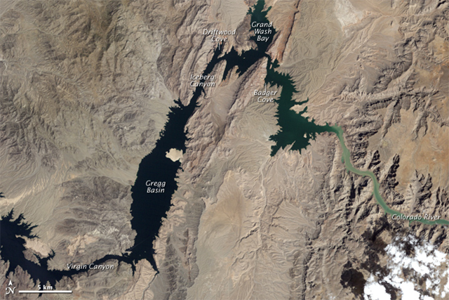 11 August 2010
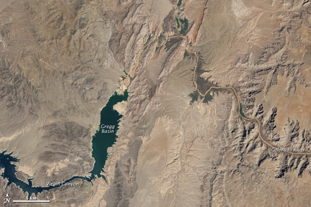
Caption by Michael Carlowicz
September 23, 2010 In August 2010, Lake Mead reached its lowest level since 1956. The largest reservoir in the United States was straining from persistent drought and increasing human demand. Two images from the Thematic Mapper on the Landsat 5 satellite show some of the stark changes on the eastern end of the lake since 1985. Badger Cove, Driftwood Cove, and Grand Wash Bay have receded to become valleys and channels of the Colorado River, which flows in from the east (image right). The shores around the lake display the “bathtub ring” effect, with a chalky white outline marking new shoreline where sediments had previously accumulated below the water. Located on the Colorado River, east of Las Vegas and west of the Grand Canyon, Lake Mead provides power and water for human activities in Nevada, Arizona, southern California, and northern Mexico. The reservoir grew up behind the Hoover Dam when it was built in the 1930s, and it can hold the equivalent of the entire flow of the Colorado River for two years. … Lake Mead reached its August 2010 low after decades of population growth in the American Southwest and 12 years of persistent drought. According to the U.S. National Park Service, the amount of water flowing out of and evaporating from Lake Mead has consistently exceeded the amount of incoming water in recent years. …