June 30, 2010
Image of the Day: BP / Gulf Oil Spill – RADARSAT Images, Trouble With Alex
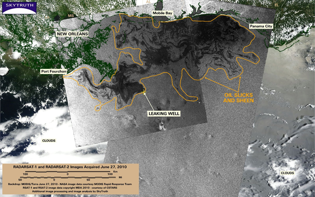
Two radar satellite images (black and white) taken by the RADARSAT-1 and RADARSAT-2 satellites on June 27, 2010, show oil slicks and sheen extending across 19,112 square miles (49,500 km2) in the Gulf. The radar images were acquired at 6:48 am (long image on right) and 6:52 pm (image on left) local time: The color backdrop is a MODIS/Terra satellite image taken early afternoon on June 27. Thick clouds from Tropical Storm Alex, passing off to the south, are visible at lower left. …
