June 24, 2010
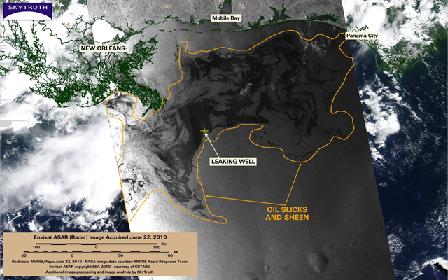
Image of the Day: BP / Gulf Oil Spill – ASAR Image June 22, 2010
Here’s a great example of why radar is the go-to tool for mapping and monitoring oil pollution (and why I think the US needs to launch a civilian radar imaging satellite). The MODIS/Aqua satellite image taken yesterday afternoon is mostly obscured by heavy clouds over the area of the ongoing BP spill. But an Envisat/ASAR radar image taken the same day clearly shows oil slicks and sheen spread across an area of 26,053 square miles.
BP / Gulf Oil Spill – ASAR Image June 22, 2010 – The Power of Radar
