May 15, 2010
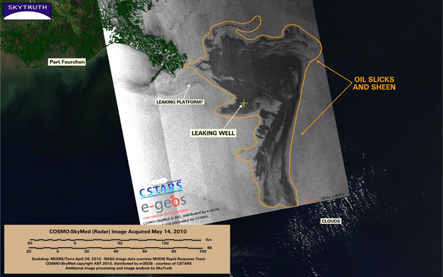
Image of the Day: BP / Gulf oil spill — Radar Image, 14 May 2010
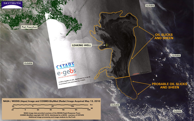
The COSMO-SkyMed radar image taken yesterday is somewhat ominous – it shows nearly all of the slick from the ongoing Deepwater Horizon oil spill, and at 4,922 square miles (12,748 km2) it’s significantly larger than it appeared on May 13.

