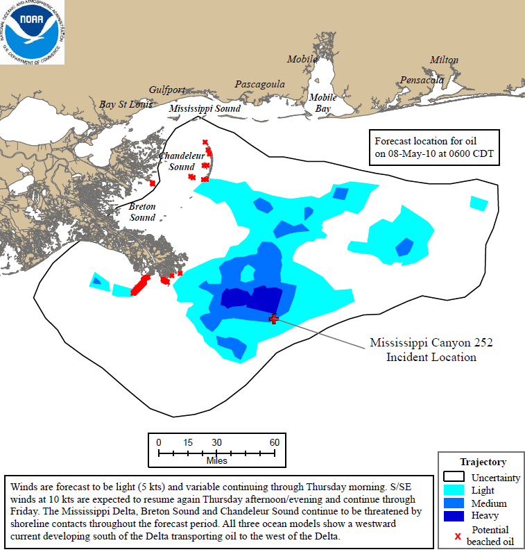
Graph of the Day: Projected Oil Spill Path to 8 May 2010
Improving weather today allowed both NOAA overflights and dispersant operations to resume. Today, four aircraft applied dispersants to the surface slick, and dispersant application by vessels is expected to begin tomorrow. Monitoring of the dispersant efforts are ongoing. NOAA overflights were conducted over the source as well as south from Mobile. At present, technical specialists and other personnel from many agencies and organizations are assisting NOAA in providing scientific support for the spill response. With further in situ burning planned for tomorrow, the National Atmospheric Release Advisory Center (NARAC), an atmospheric hazards prediction team at Lawrence Livermore National Laboratory, will begin predictive modeling of the smoke plumes. Meanwhile, NASA has volunteered use of a reconnaissance aircraft for NOAA’s use in conducting overflights of the affected areas (during overflights, trained observers record locations of oil, affected wildlife, and other relevant observations). Yesterday and today, new command centers were “stood up” (initiated) in three locations around the Gulf of Mexico, including new area command centers in Tampa-St. Petersburg and Key West, and a new national command center in New Orleans. Twice daily, NOAA oceanographers continue to release updated trajectory maps showing the predicted trajectory of the oil slick. Drifter buoys have been placed near areas of the slick to provide tracking data that will be used to ground truth NOAA’s predicted trajectories. The buoys, places at the edges of the slick, transmit location information and can be used by the NOAA modeling team to better understand how currents and winds are moving the slick and accompanying buoys. …
