Image of the Day: Bear Glacier Melt Viewed from Space
By Claire Bates
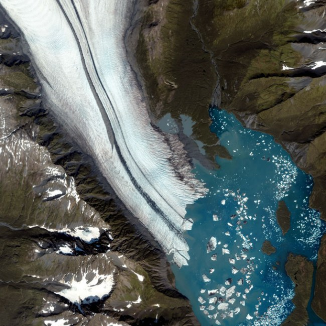
Last updated at 8:02 AM on 23rd September 2009 These awe-inspiring images of glaciers are helping scientists to determine just how quickly our planet is heating up. The huge ice fields are thought to be one of the most reliable indicators of climate change and are best studied from space. The features form when snow accumulates on an area of land over tens to hundreds of years. It eventually becomes so thick and heavy that it forms dense glacial ice. When enough ice is compacted it beings to flow downhill or spread across flat land. NASA scientist Dorothy Hall said: ‘Glaciers that tend to be good climate indicators are small-land based, non-surge type glaciers. They respond directly to both regional temperature and snow.’ She and a team of scientists from around the world have used satellites to monitor changes in these glaciers in Europe, Iceland and Alaska. Glaciers tend to extend in many different directions with one part retracting while another part stays still. Therefore satellites such as Landsat 5 are essential as they can measure the entire rim by analysing the different wavelengths of light bounced back from the ice. …
Stunning pictures of glaciers from space reveal worrying signs Earth’s ice is melting away