October 16, 2009
Graph of the Day: Deforestation in Sumatra, 1990-2000
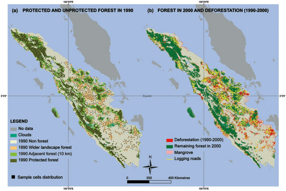
(a) Protected and unprotected forests in 1990 for the main island of Sumatra and the smaller island of Siberut, including adjacent unprotected land lying within 10 km of protected area (PA) boundaries and the wider unprotected landscape, and showing the spatial distribution of the 1264 sample cells (25 km2). (b) Remaining forests in 2000, deforestation and logging trails occurring during the period 1990–2000 (UTM projection, WGS84). Protected areas (PAs) protecting mangroves or created after 2000 are not shown. MAPS available at sumatranforest.org.